It was a complete surprise to find a dusting of snow :-)
We saw three lots of deer, and I actually managed to take a reasonable photograph of one of them.

I used RunGPS to track the little walk :-) 2.96 miles in 1 hour 15 minutes...Route here...
When we got back home I had a bacon sarnie then got changed for cycling...
I ended up setting of at 12:30, I loaded the planned route into the Garmin started pedalling, apparently I was heading in the wrong direction ...I stopped reloaded the course then set off again....It confirmed the wrong direction so I headed off following the route...I realised that the route had me heading North...I was supposed to be heading south!
So I stopped and reloaded the route again, this time it loaded the correct route :-) once I had navigated onto the right track I was finally off....
It was potentially not a very clever plan to head south when there was a particularly strong northerly wind..
| 1300 | 3.5 °C | NNE | 14 mph | 40 km | 1023 hPa, Falling | ||
| 1400 | 3.2 °C | NNE | 14 mph | 35 km | 1023 hPa, Falling | ||
| 1500 | 3.1 °C | N | 13 mph | 30 km | 1022 hPa, Falling | ||
| 1600 | 3.4 °C | NNW | 8 mph | 30 km | 1022 hPa, Falling |
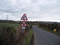
I was interested by the ICE sign...

It definitely wasn't icy, I do wonder about the logic in having a permanent sign for ice, why not have one for Sunshine.
The roads were superb....

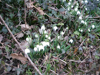
And I finally managed to take some pictures of Snowdrops...in my mind the start of spring :-)

The roads through Longleat were superb.


After Longleat the plan was to head to Shear Water, unfortunately the road was blocked with a gate, so I headed straight to Warminster and re-joined the planned route.
The ride back home was as tough as expected :-(
The Garmin had today's ride as 63.41 miles in 4 hours 23 minutes with an average speed of 14.5 mph...route here...
I think the Garmin had a hissy fit earlier on as one of the courses I had copied to it was corrupt, I have now removed it, so hopefully it will play properly tomorrow.

0 comments:
Post a Comment